I visited the Shetland Islands in 2015 and again briefly in 2018. I went again 2019 and 2021. The Islands sort of grow on you. The islands are notable for the number of Neolithic house remains, a multi occupied site known as Jarlshof and an interesting so called Stanydale “temple,” a roofed building which was possibly a community hall or religious gathering site. There are single chambered cairns 3000-2000 BC, oval neolithic and round bronze age houses, some rock art, and strange burnt mounds (500 BC to 0 AD)
Orkney has the huge megalithic cairns and stone circles. The monuments in Shetland are more intimate – Neolithic heel-shaped cairns with an entrance passage leading into a small chamber. Later burials are in cists. Discover Shetland and Kittywake Tours do excellent tours. Best easy book on the subject is Prehistoric and Viking Shetland by Noel Fojut (2006) and A Photographic Guide to Shetland’s History by David Malcolm. Here are some of the sites I saw in alphabetical order. If you click on the small photos most of them will become larger. I can supply larger photos if you want.
Just by the side of the Heritage Centre, near the ferry, is a reconstructed burnt mount showing how it looked when excavated (elsewhere). Burnt mounds date to the bronze age, and are some kind of workplace, either for communal cooking or, less likely, for making hot water used for some other purpose. Burnt mounds are found where there is a a supply of water. There are heat-cracked stones that are put into the wat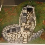 er to heat it up and a hearth. Could this be a way of slow cooking large bits of meat, or just a response to the lack of trees on the island – fuel might be easier to find for a communal fire. This small reconstruction of a burnt mound is from the museum. Click on both these photos for a better view.
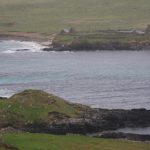 This large mound is a ruined broch, just close to the ferry to Noss. There are large mounds like this all over the Shetland Islands that have never been excavated. I was so cold at the time that I didn’t go down for a closer look! But there are ramparts and perhaps a stone faced wall.
No 103 of Prehistoric and Viking Shetland.
The ruins of an medieval church with its graveyard. The graveyard rises at one side to cover the foundations of a broch. In the graveyard is a replica of a Pictish stone (now in the national museum). There is also a burnt mound at the beginning of the track towards the church. There’s a good video showing this at here
No 119 of Prehistoric and Viking Shetland.
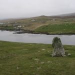 An upright standing stone not far from the road just past the last house in Mid Field. Legend says it is indestructible – if only. An easy one to find and visit.
No 64 in Prehistoric and Viking Shetland
A walk from a nearby farm on the road, past a loch, and then an easy ascent up grassy Vord Hill takes you to three cairns on the top. The summit cairn not far from the triangulation pillar is the smallest – heel shaped with no sign of a central chamber. Further along, looking over the coast towards Unst, are two further cairns. The South cairn has a World War 2 watch house built into it and a circular enclosure said to be later than the cairn. There is a visible entrance. The North cairn is so large that it looks almost as if it was a double cairn measuring 17 by 15 metres. A lovely view and spotted orchids along the walk up the hill. The three cairns were scheduled in l998. Fetlar does not list them in his gazeteer.
 Pause on your way from Lerwick to the airport on the A970 and you will see this little island in a loch. Duns are fortified houses, smaller than brochs, usually with a causeway across the water built on an artificial island. They probably date from the 7th century and may have had an inner and an outer wall. Unlike the brochs, which were often surrounded by several prehistoric houses, duns would have been much smaller and presumably for a single family.
.
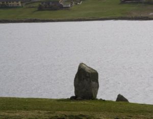 This stands on the hill looking down into the loch, east of the road to Busta, just before the cattle grid. There is a second stone nearby which may be fallen companion. There are various standing stones in the area which may be modern sailing marks but this looks like a Neolithic one because of its size.
No 49 in Prehistoric and Viking Shetland.
Brochs are Iron age circular towers 100 BC to 100 AD. Probably defensive, though it is not clear why it was suddenly necessary to build them. There is often a circular wall round them. The site started life as a simple fort with wooden buildings, then a fortified blockhouse was added and finally a broch. This is within walking distance from the centre of Lerwick or a bit of a longer walk via the scenic headland.
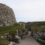
Side of broch with iron age houses is an easy walk from the centre of Lerwick and is free admittance.
No 21a in Prehistoric and Viking Shetland
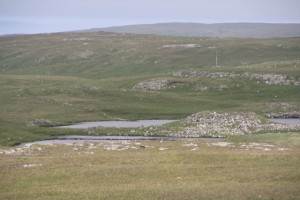 This is just a long distance shot of a ruined broch, now on an island in a lake. For a rebuilt broch go to Moussa broch lower down this page. This is on Moussa island and you can actually go inside.
On the Boergs of Housetter lies the Giant’s garden, a hill full of tumbled rocks. On the slope facing the brook is semi-subterranean series of Pictish cells first excavated by Robert Munro in 1902. At one end of an enclosure he described a series of cells, some with passages between. A later official archeology visit in 1969 claimed that no connecting passages were visible. The enclosure is undated and is probably more modern because it seems to be built over some of the cells. From the enclosure a second enclosure can be seen. Archeology Shetland has revisited the site and suggests that the cells or houses were Pictish. Read it here. There is no mention in Prehistoric and Viking Shetland. These half-subterranean homes are found in Shetland Iron age villages but this is an odd location. There is a good talk about Iron age and Pict houses on Youtube here.
Two upright standing stones, visible from the A 970. These are the facade of a cairn. the curving horns of the traditional heel shaped Neolithic Shetland cairn. The rest of the cairn is now destroyed but for a few stones on the surface just behind them. They are a beautiful pink granite. Large standing stones at the facade of a cairn are unusual in Shetland. Folklore says they mark the grave of a giant.
No 43 in Prehistoric and Viking Shetland.
A semi-circular cairn, heel shaped, ie rounded at the back and with a facade at the front. The entrance may have been blocked after abandonment of the grave. A rectangular single chamber. The setting is beautiful and worth the walk from Mavis Grind to the head of the bay. No 48 in Prehistoric and Viking Shetland. There are unexcavated chambered cairns all over the place, small compared with the huge passage graves of Orkney.
This is the site that is on everybody’s tour of the Shetland mainland. Well worth it, too. It is a site that was occupied from Neolithic times.
The photos show the first neolithic house (left) , 2500-1500 BC, and the later bronze age building, 800 BC, which was a metal working smithy (right). Unless they just worked copper, they would have needed to import tin – perhaps from as far away as Cornwall.
On the left second down is an Iron Age house, more roomy than the neolithic one. On the second right down is the next building in time – the outside wall of a broch 100 BC-100 AD. Then a very well preserved wheelhouse (last photo) 200-300 AD. Wheelhouses have a roof supported by dry stone walled piers arranged like the spokes of a wheel. This may help with the absence of trees on the island. All wood had to be drift wood.
Later the site was occupied by the Vikings – there are remains of their long houses. Then a medieval farm was on the site.
And finally a Scottish laird built his posh house on it, partly covering the site of the broch. That too is a ruin now.
This site is the visible history of the Shetland islands and must not be missed.
Jarlshof is no 25, in Prehistoric and Viking Shetland.
The best preserved broch, iron age tower, in the Shetlands. Well worth making the effort to see it as you can go inside and walk up the circular stair (on the inside of the tower) to the top. Was it a look out? A defensive structure? A posh house for the clan leader? Why did they suddenly have to build these huge defensive structures in 100 BC to 100 AD? Inside the stairs were wooden beams holding up six circular galleries. On the floor of the broch is a rock tank for water and a hearth. Many, if not all, brochs had a village surrounding them – see Gurness broch on the Orkney page. There’s a ferry boat from the mainland. Stormy petrels, tiny little birds that fly out and in only at dusk and dawn, net in the stonework and in the stone walls on the island. If you listen carefully and silently you may hear them purring on their nests.
No 105 in Prehistoric and Viking Shetland.
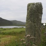 A standing stone near the road just near the Tingwall loch which has a little mound on it. This is where the Ting, the thing, the law assembly for Shetland, was held by the Vikings but excavations suggest nothing much remains. Later the Ting was held in the church nearby. Until the 18th century there were said to be large stones there on which the people sat. Not impossible. Stones, sometimes prehistoric ones, were used as assembly points (see the Kiftsgate Stone in Gloucestershire, a moot stone) or stones used for crowning kings (the stone of Scoon or the King Stone in Kingston). The record is here.
No 61 in Prehistoric and Viking Shetland.
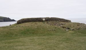 To reach this blockhouse, on the end of a promontory, it is necessary to walk across a rocky spine. Luckily there is an iron rail to help keep you from falling. A double ditch on the land side cuts off the fort from the mainland. The narrow entrance passage has one square cell to the left of the low entrance passage and two small suare cells on the right entered from the rear. It is thought it was originally twice its current height. There are no other buildings here.
No 11o in Prehistoric and Viking Shetland.
This is a substantial Neolithic farm house, with a large entrance “porch, and a substantial boundary wall leading down to the loch. Nowadays it is set in a remote landscape with peaty moorland. There is intervisibility between this farm and the cairn on a little hillside nearby.
No 8 in Prehistoric and Viking Shetland
This looks like a huge heap of stones on a little hill overlooking the loch until you get closer. Then you see that it is apparently the best preserved cairn on the Mainland. The entrance is a passage between the curving horns of a facade.
No 47 in Prehistoric and Viking Shetland.
This cairn stands on the top if the highest hill (small mountain) in Shetland. Said to be the best preserved cairn in the islands but it has been added to by walkers and climbers so that it has become a kind of cone rather than a heel shape. The going is rough and if the mist comes down it is possible to get lost.
No 44 in Prehistoric and Viking Shetland
Not far from Stanydale (below) is the site of a Neolithic houses. It is a whole neolithic landscape which you can see if you walk to the top of the hill (where the notice board is) and look downwards. A little further on is Galley hill, with a long Neolithic dyke (Shetland word for a wall). These are not unlike the very early reeves on Dartmoor in function.
No 15 in Prehistoric and Viking Shetland
This is the Stonehenge of the Shetlands – an exceptionally large Neolithic house, easily twice as big as some of the neolithic oval houses nearby (see photo on the above right). A temple it isn’t! We know it was probably roofed because there are two post holes in the centre of the building. As Shetland is, and presumably was, almost without trees, these holes presumably held tree trunks that washed up on the shoreland. Pottery from here suggests it was in use from the late Neolithic through the Bronze Age. Number 18 in Prehistoric and Viking Shetland.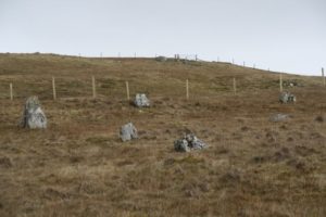
The photo to the right show standing stones to the south of the main monument. Calder, the original excavator, suggest they are “all that is left of a complete circle or oval that may have surrounded the building.” With modern excavation techniques this might be established.
His original paper, “Report on the Excavation of a Neolithic Temple at Staneydale in the parish of Sandsting, Shetland,” Inventory of Shetland, Twelth Report, vol iii, 185-205 is available via the Staneydale Wikipedia entry.
The remains of a heel shaped cairn not far from the Giant’s Grave, the remains of which now appear circular. Excavated in 1904. It contained paved flooring and some charcoal remains. The name means “fairy mound.” No 43 in Prehistoric and Viking Shetland. This is a beautiful site. I did not visit the smaller cairn further back in the scree.
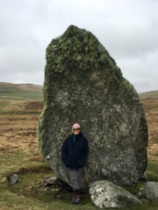 Probably the hugest standing stone in Shetland, 3.8 m high and thick with it. A real whopper! I have put myself in the photo this time to show how large it is. This stone is in Unst. I was taken there by David Malcolm, historian and guide, and his daughter Kitty of Kittywake tours. David took the photo.
No 30 in Prehistoric and Viking Shetland.
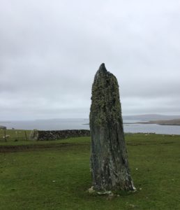 A slender upright stone not far from Muness castle in Unst. There is a companion stone, squat shaped and built into a wall. You can just see it at the back of the photo. Worth a look at the ruined castle while you are there.
No 31 in Prehistoric and Viking Shetland.
A ruined broch with ramparts on the edge of a slope leading down to the site of several Iron Age round houses and a souterrain (see lower right). On which has been built a rectangular Norse house (see lower left).
No 88 in Prehistoric and Viking Shetland.
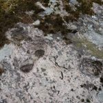 Several groups of pecked cup marks on a rock outcrop. Most are not easy to see due to intruding moss and lichen. We found about a dozen but there are apparently at least 30. Rock art like this is said to be rare in Shetland but it is possible that nobody has looked very hard for it. This is the only clear photo I could take: lichen made the others difficult to photograph. Worth clicking on the photo to see them more clearly.
No 40 in Prehistoric and Viking Shetland.
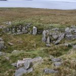 A cloverleaf house – larger than some of the simpler Neolithic oval houses and probably a farmhouse. Excavated in the 1950’s by Charles Calder who excitably claimed it was a priest’s house for a nearby “temple” (the Stones of Yoxie) lower down the hill. From here you can just see the cairn on the hill higher up.
No 2 in Prehistoric and Viking Shetland.
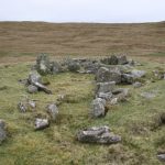 Interpreted as a temple with a forecourt by Calder, but just a prehistoric house with a windbreak type porch. Just walk down the hill from the Benie Hoose. It is quite a substantial house like Benie Hoose, suggesting that the inhabitants were relatively prosperous. There is no beach access to the sea, though the cliffs would give access to birds and eggs for a good climber. From here you can just see the cist in the cairn on the hill higher up.
No 3 in Prehistoric and Viking Shetland.
On the hill above the Benie Hoose is a small chambered cairn with a marrow passage from the facade. A cist at the end of the cairn is probably of a later date. The cairn may have been extended to incorporate it. You can see the capstone of the cist sticking up at the end in the centre photo.
No 39 in Prehistoric and Viking Shetland.
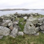 Just a walk up the hill from the ferry and worth it for the view alone. There is a curb round the cairn which is still visible. There is an astoundingly good Heritage Centre just up the village hill with wonderfully friendly volunteers. Do not miss this. You might even get a cup of tea.
No 41 in Prehistoric and Viking Shetland.