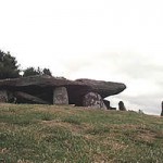
 A Neolithic passage or chambered tomb, 3700-2500 BC. To get there take the small road uphill leaving the Red Lion pub in Bredwardine on your left and just keep going. The road veers right leaving the Golden View to your right and becomes Arthur Stone lane on the border of Dorstone and Bredwardine, along the ridge of the hill with a spectacular view.
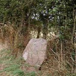
The stones are surrounded by post and rail and labelled. Turning back towards Brewardine, there is what is probably a small standing stone on the left near the gateway in the hedge.
This might be connected with the original shape of the monument see Re-evaluating Monumentality, Arthur’s Stone, by George Nash, 3rd Stone vol 45 Winter 2003. Or it may be an independant single stone or part of a row. These are often found near barrows as part of a sacred or special area either predating or post dating the barrow itself.
Not far away is a Dorstone long barrow, bulldozed during the war, with cremated remains 3710 BC and 350 bits of worked quartz. Also a causewayed enclosure with single of multiple ditchec c. 3600 BC. 3 huge stones were found in the 2018 escavation by Julian Thomas, possibly a dolmen. A substantial scatter of mesolithic microliths shows this was an important site early on. Blog at https://dorstonedigs.wordpress.com/
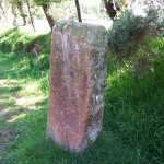
 This looks more like a gatepost than a standing stone though there are no holes for hinges etc.
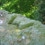
It is shaped with a W carved into the top and a surveyor’s mark. “Stone Spotting in Herefordshire” by Jonathan Sant (Moondial) claims that it is one crossing place of old tracks, though only one is marked as a foothpath on the OS. As this is on the parish boundary of Michaelchurch Escley and Dorstone, not far from the road along a track leading to Vagar Hill, is it a boundary stone?Or an estate marker? What is the W? It is not mentioned in the Guide to Prehistoric Roman Sites in Herefordshire, produced by the Woolhope Club but the online sites and monuments record (www.smr.herefordshire.gov.uk~) lists it.
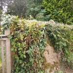
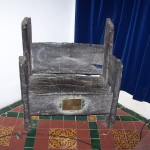
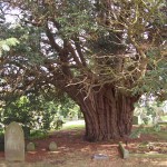 Just to the right of the gateway of the churchyard stands a stone in the hedge – about four and a half feet high and about three feet wide. The Herefordshire sites and monuments record says ‘it is assumed that the stone is not in its original location.” (Stone tip seen over the hedgin the picture is just a gravestone.) Worth seeing see St Augustine’s chair (probably not authentic) inside church. the churchyard yew is 1,200 years old – authentic! Not far from the church is Jumpers hole in the Whelpley brook, strewn with boulders.
 One of them three horseshoe dents, and an oval hollow. These are said to be the marks of a witch’s horse. She had stolen loaf of bread and as she jumped the brook, the loaf fell on to the stone. I looked at the crossing marked ford on the Explorer map (now with a footbridge) and could not find this stone.
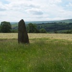 The tallest stone in Herefordshire and also known as the King Stone. Legend has it that a farmer once hitched up 12 horses to move this tone but could not do so. Actually it fell down of its own accord due to having so little of itself buried below ground but was restored. It stands in the countryside of Arthurian legend with Merlin and Mordred being buried in this area. It is in the valley below.